3D Scan Process

On-site Surveys

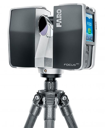
  • Reduce the time spent on site and gather reliable readings by using the on-site 3D scanner.
  • Remote unreachable areas can be modelled precisely.
  • The readings include a succession of several shots, called stations. By multiplying the number of shots, the environment can be captured from all angles.
scanner 3d faro

Data retrieval

  • Raw readings are retrieved using the Scene software.
    This software compiles and assembles the different shots taken by the on-site stations.
  • Combining the data from the different stations is achieved using the automatic recognition of elements within the environment.
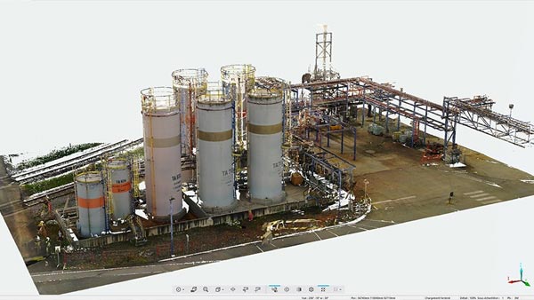
  • This results in a 3D photograph or a point cloud that can be used with CAD systems.

Modelling

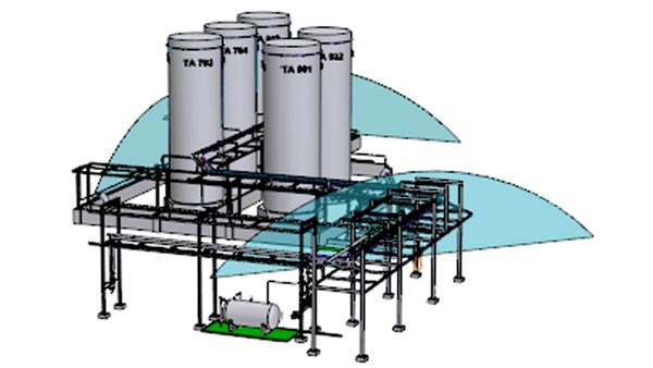
  • Once the required scans are complete, the existing and new installations can be modelled using the chosen drawing software (MICROSTATION or other), precisely extracting the required shapes and markers via the SCENE software.
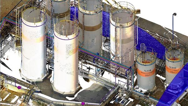
  • New developments can be integrated onto the retrieved point cloud, so as to show the projected installations in the existing environment.

3D Scan Examples

Project : SOBEGI solvent tank farm in Mourenx – Ensuring compliance of the fire network

Point Cloud

exemple de nuage de points

Modelling the installation using MICROSTATION

modélisation de l’installation grâce à MICROSTATION

Integrating the new lines
in the point cloud

Intégration de nouvelles lignes dans le nuage de point

Example of a 3D video of the installation using the shots taken from the stations

Webshare


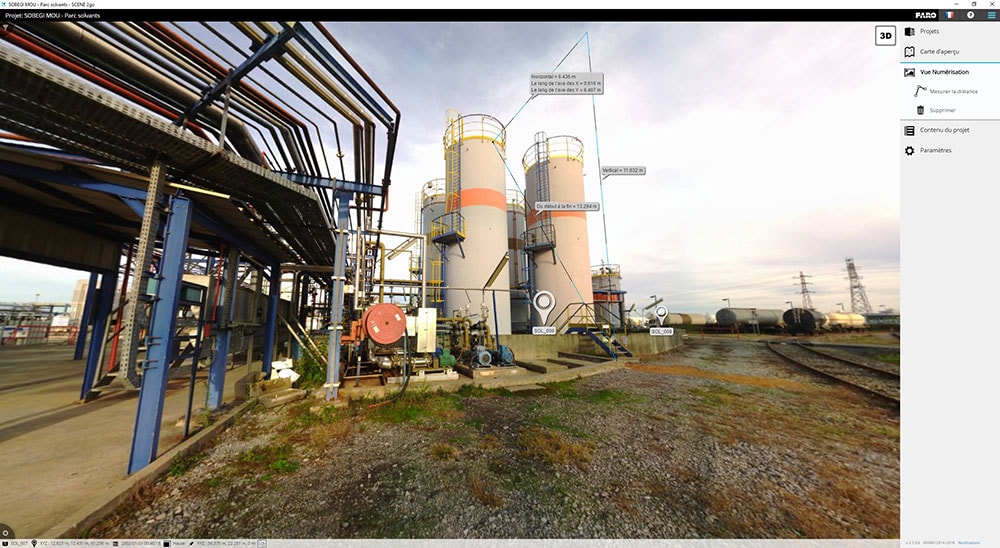
A file including a transcription of the readings taken into a drawing (figure 1) can be provided as well as the option for the user to select any shooting station (figure 2), with a 360° view.
Dimensions of the existing installation are also available in this file.

visite 360° -prise de côtes

View from one of the stations

aperçu de la visite 360°

Drawing created from the 3D scanner station readings